SWaDE draws on open-source satellite data feeds from the European Space Agency and NASA. Its proprietary AI converts this into validated, consistent data — delivering agricultural intelligence to farmers and financial insight to the institutions that serve them.

A Data-as-a-Service platform built for smallholder agriculture, starting in Ethiopia.

Get in touch
The translation gap

The data exists. The gap is converting it into something usable.

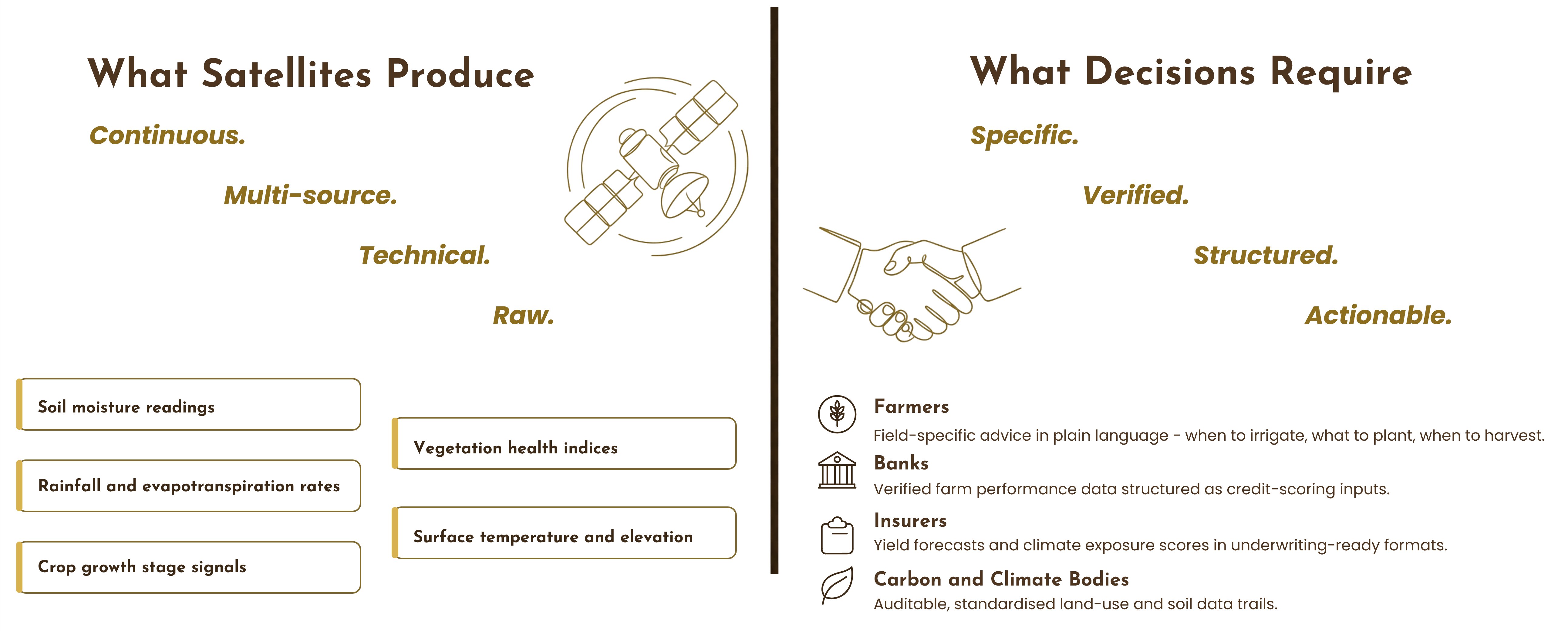
Satellites continuously collect agricultural data across every field on earth — soil moisture, rainfall, crop stress, vegetation health. But that data arrives as raw, multi-source, technical feeds. No existing platform converts it into the formats that farmers, banks, insurers, or carbon bodies can act on. SWaDE's proprietary AI is that conversion layer.

What satellites produce versus what decisions require
Introducing SWaDE

Introducing SWaDE: One platform, five agronomic solutions. Verified data for finance and insurance institutions.

Crop Yield Estimation
Satellite-based forecasts from planting to harvest, enabling proactive farm management at every stage of the growing cycle.
Irrigation Demand Forecast
Precision water scheduling reduces usage by up to 40% — saving cost and preserving a critical resource.
Climate Resilience
Early warnings for drought, flood, and pest outbreak — giving farmers the lead time to act rather than react.
Pest Management
Satellite-detected crop stress signals identify infestations before they take hold, cutting losses at the source.
Soil & Land Use
Soil health mapping guides fertilisation decisions and land conservation, maximising yield from every hectare.
85%+
Prediction accuracy achieved in pilot trials.
Agronomic data doubles as financial risk signals — enabling credit scoring, insurance access, and carbon credit eligibility.
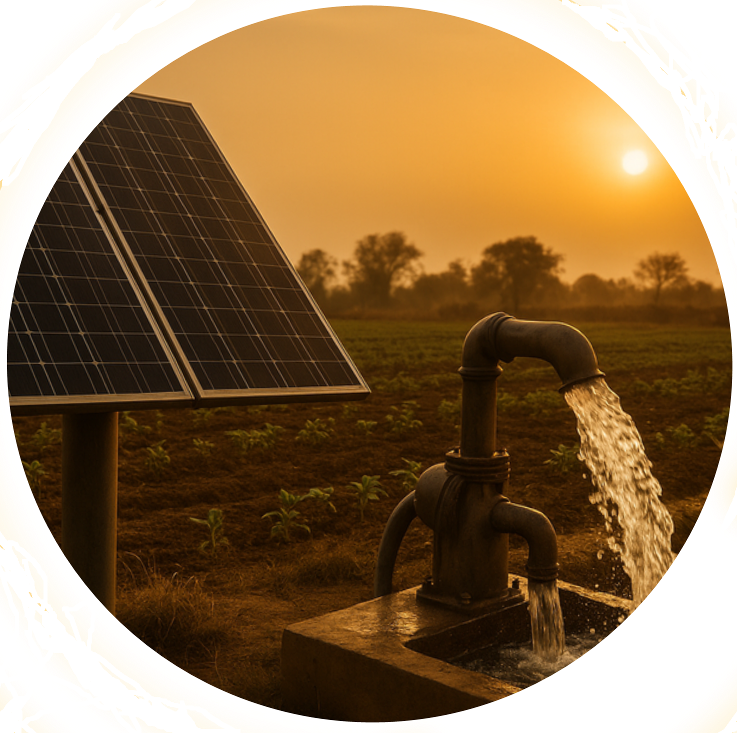
Solar pump irrigation in Ethiopia
IoT Integration
SWaDE is a software solution that stands alone — but integration with hardware transforms what farmers can do with its intelligence.
The platform

Putting actionable data in the hands of the farmer, and the financier.

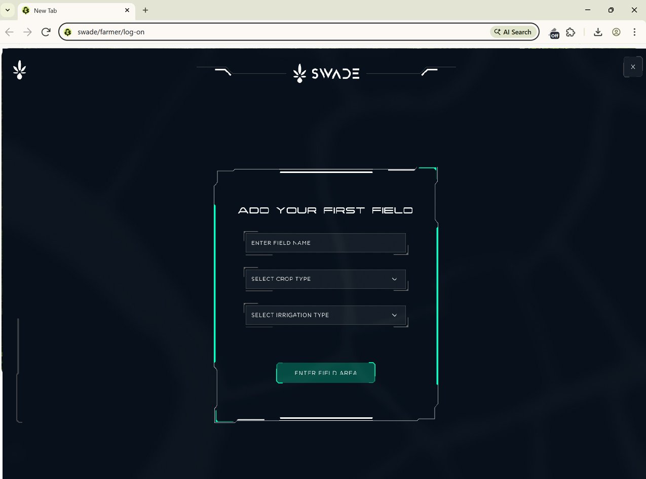
The SWaDE platform is accessible via web, tablet, and mobile, designed for field use and institutional analysis alike. Structured data sharing facilitates connections between farmers, agronomists, cooperatives, and financial and insurance partners.

SWaDE web interface in browser
Web interface — full analytical capability on any browser
SWaDE on tablet
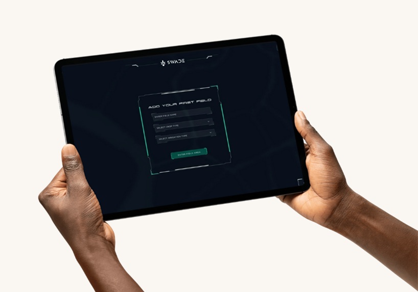
Tablet — designed for field use and cooperative meetings
SWaDE on mobile
Mobile — accessible with limited connectivity in the field
01
Field Registration

Add and configure a farm field using multiple input methods — draw the boundary directly on the map, enter coordinates manually, or upload a field file in GIS format. The system validates the polygon and assigns it to the farmer's account. Platform access is gated behind a completed farm profile, ensuring data quality from the first interaction.

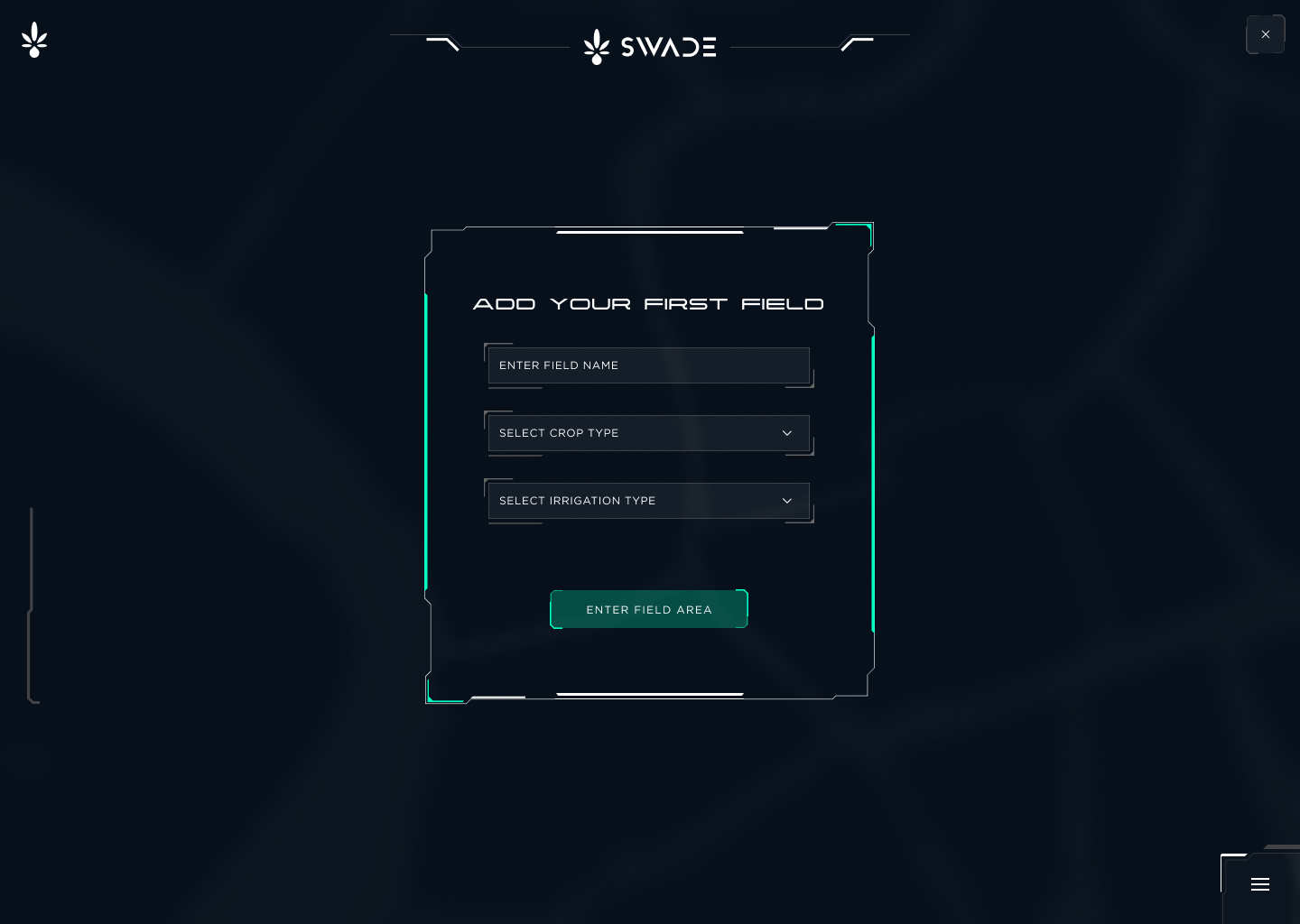
Field registration screen
Field configuration Field name, crop type, soil type, and irrigation method are captured at setup. This data informs the satellite analysis from day one.
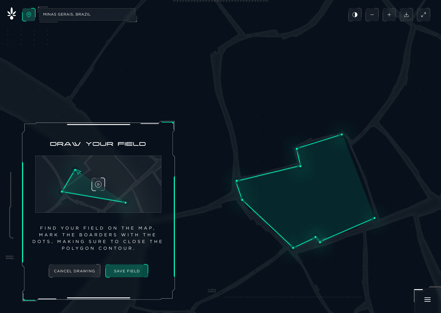
Draw field boundary on satellite map
GPS boundary mapping Farmers draw their field boundary directly on a satellite map. The polygon is stored and continuously matched against incoming satellite feeds.
02
Data Visualisation

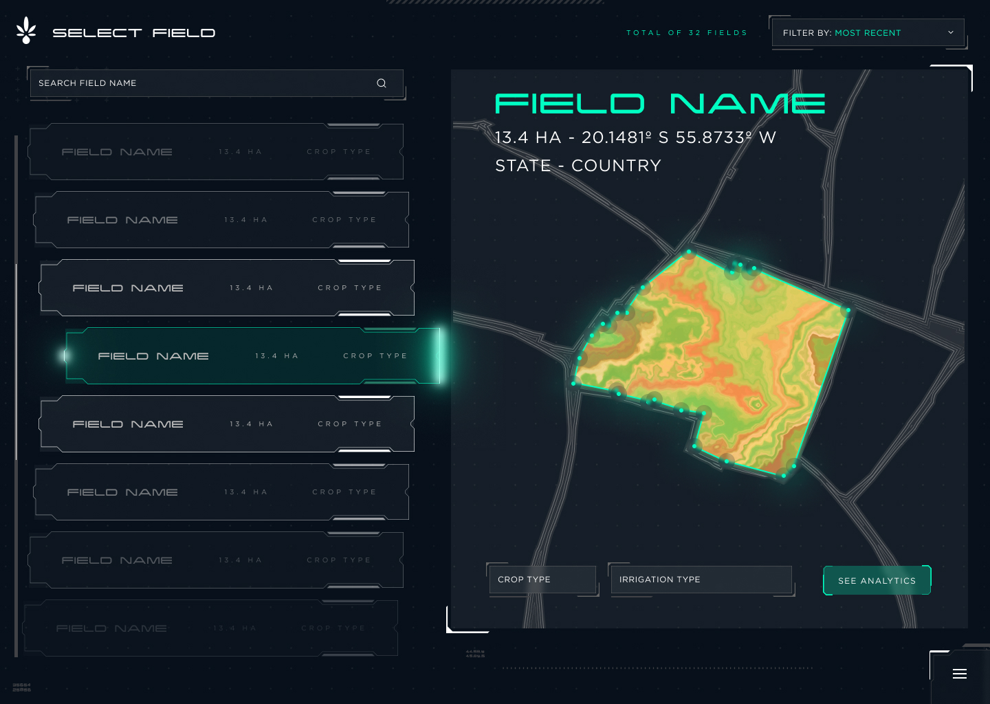
Heatmap overlays, time-series analytics, and real-time soil and weather intelligence per field. Once a field is registered, the farmer selects a time range and data layer — soil moisture, vegetation index, evapotranspiration, weather, or irrigation demand — displayed as a heatmap overlaid on the field polygon.

Field selection with satellite heat map overlay
Satellite data overlay Registered fields are overlaid with processed satellite data. Vegetation health, soil water retention, and irrigation estimates update continuously from ESA and NASA feeds.
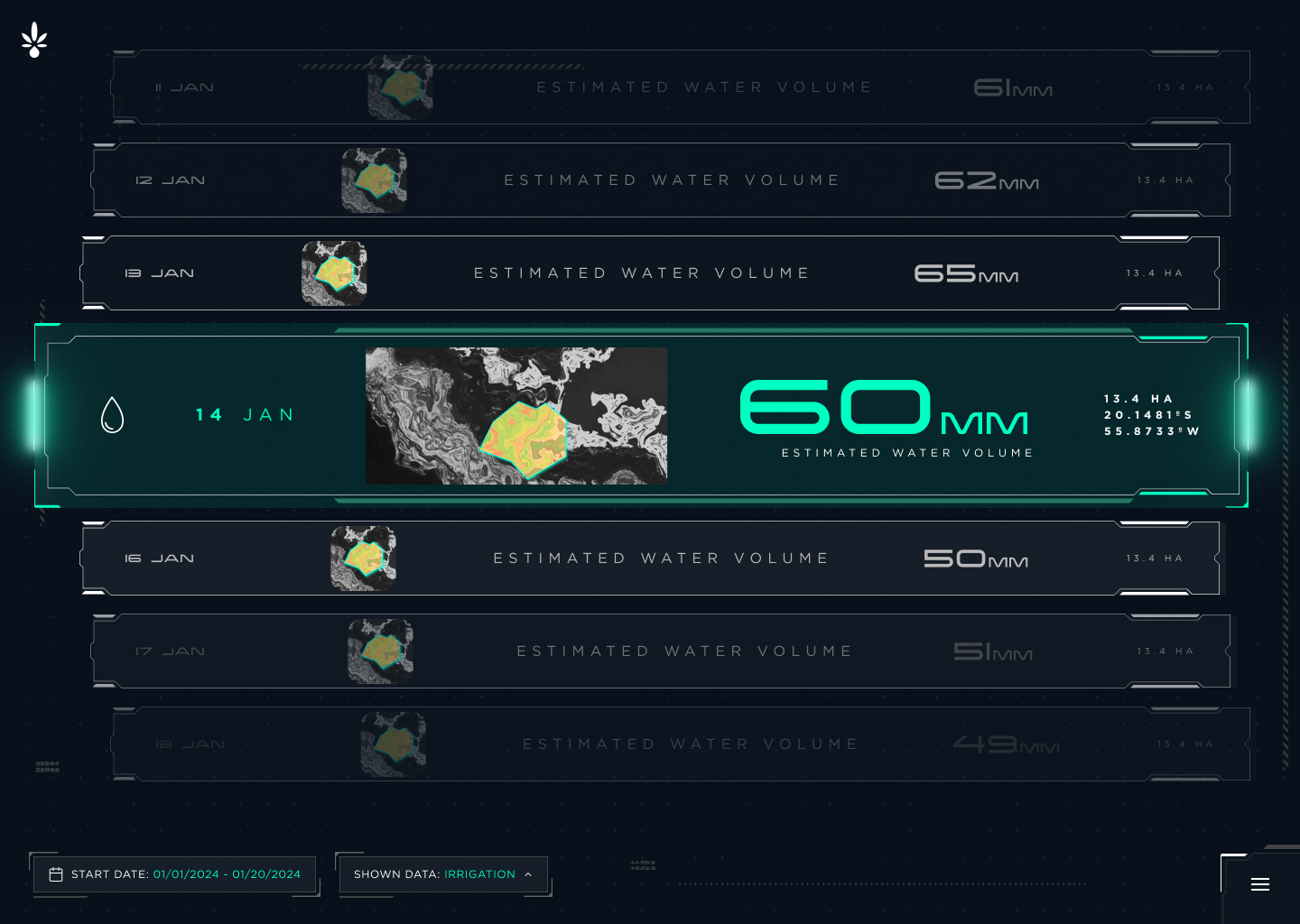
Irrigation forecast cards view
Irrigation forecast — daily cards view Daily estimated water volume per field, drawn from satellite soil moisture and evapotranspiration data, giving farmers a clear irrigation schedule in plain figures.
03
Advanced Analysis, Export & Collaboration

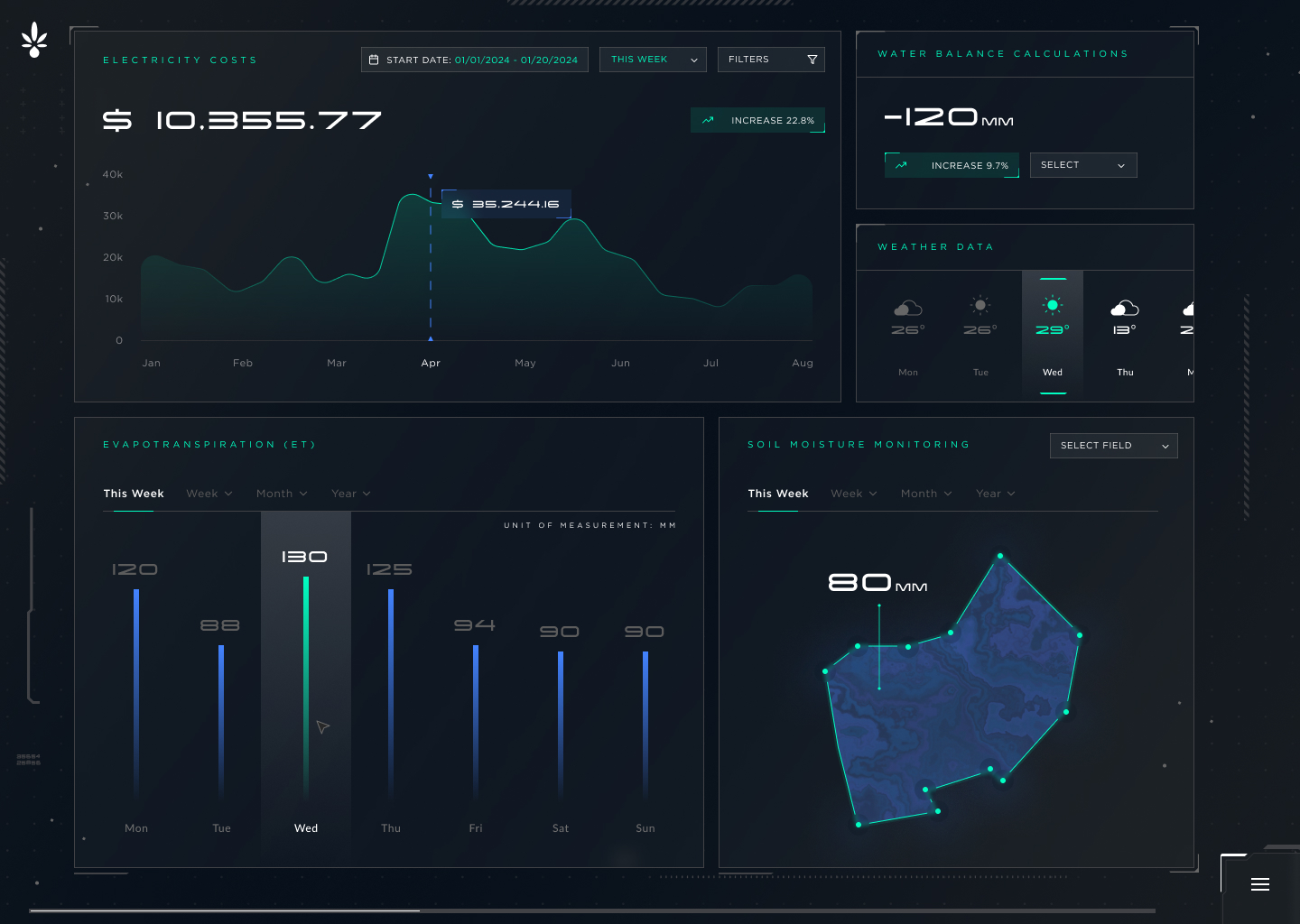
A coherent dashboard maps irrigation demand against energy cost, soil moisture, evapotranspiration, and market forecasts simultaneously. Farmers, agronomists and cooperatives can download data as CSV, map image, or forecast summary, ready for immediate use.

Financial, insurance and carbon credit institutions receive verified datasets, allowing them to make critical risk calculations.

Advanced analytics dashboard
Institutional analytics dashboard Electricity cost tracking, water balance, weather data, evapotranspiration, and soil moisture monitoring — structured as exportable outputs for credit scoring, insurance underwriting, and climate reporting.
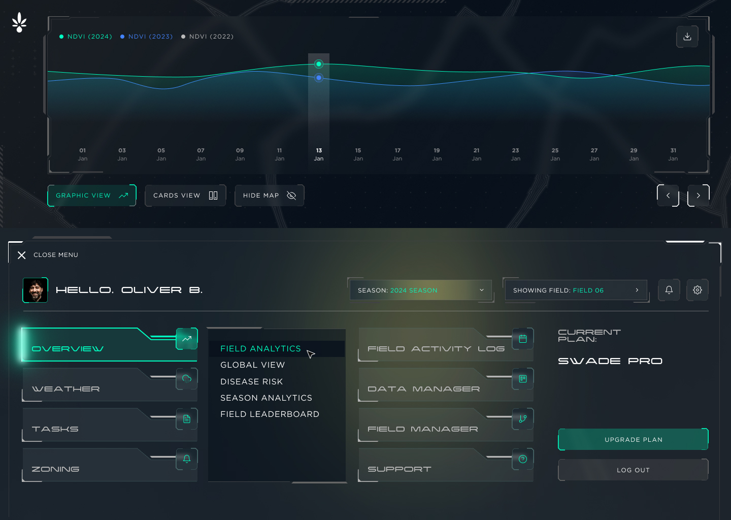
SWaDE platform menu and field analytics navigation
Multi-field management & collaboration Field analytics, disease risk, season analytics, and field leaderboard — accessible across multiple fields. Data can be shared directly with cooperative partners, banks, and insurers from within the platform.
The data product

One platform. Two distinct customers. A flywheel that compounds with scale.

SWaDE's revenue comes primarily from institutional customers — banks, insurers, carbon bodies, and government agencies — who purchase the validated farm data SWaDE generates as a byproduct of delivering agricultural intelligence to farmers.

Farmers receive
Irrigation demand forecasts, reducing water use by up to 40%
Crop yield estimation from planting to harvest
Early warnings for pest outbreaks and disease
Climate resilience alerts and soil health mapping
Institutions receive
Validated farmer profiles structured for credit scoring
Yield and climate exposure data for insurance underwriting
Auditable land-use and soil data trails for carbon bodies
Custom analytics for policymakers and government agencies
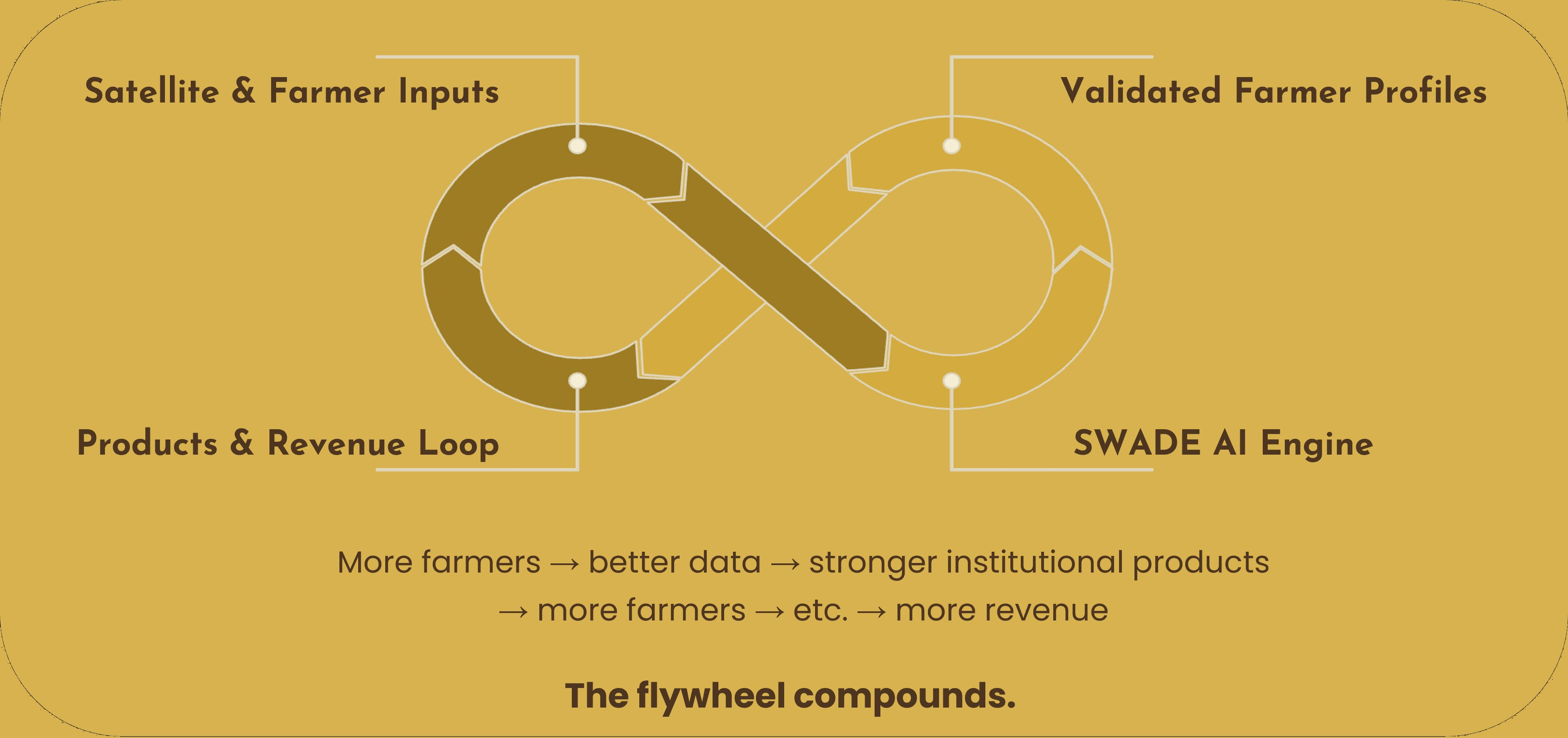
SWaDE flywheel diagram
The flywheel

Farmers enter data and receive guidance. Satellites verify progress. Banks, insurers, and carbon credit providers purchase the validated profiles SWaDE generates — attracting more farmers, improving model accuracy, and reducing the marginal cost of each additional farm toward zero.

The team

The team

Dr Lensa E. Jotte
Dr. Lensa E. Jotte
Founder & Director
Ethiopian Ph.D. hydropower engineer, Earth Observation specialist, and WEAP modelling expert. Member of Ethiopia's Ministry of Irrigation national working group. Deep embedded field relationships across Ethiopian agriculture.
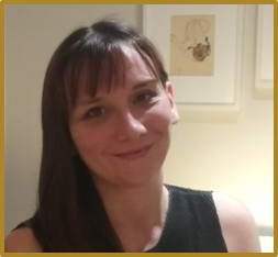
Susan Long
Susan Long
Commercial Director
Cambridge engineer; M&A advisory at PwC Transaction Services; Master's in International Trade; multi-country roles at UNIDO. Scaled an emerging-market start-up from a $40,000 pilot to $2M+ multi-country operations.
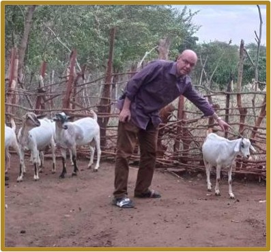
Dr Fabio Vescovi
Dr. Fabio Vescovi
Chief Technology & Agri Data Scientist
PhD, Agricultural Sciences. Twenty years applying satellite technologies to smallholder farming across Africa and Europe. Senior roles at Airbus DS and Cropin. Expert Evaluator for ESA's Galileo and Copernicus programmes.
Ethiopian field knowledge  ·  UK-based strategy  ·  India-based engineering capacity
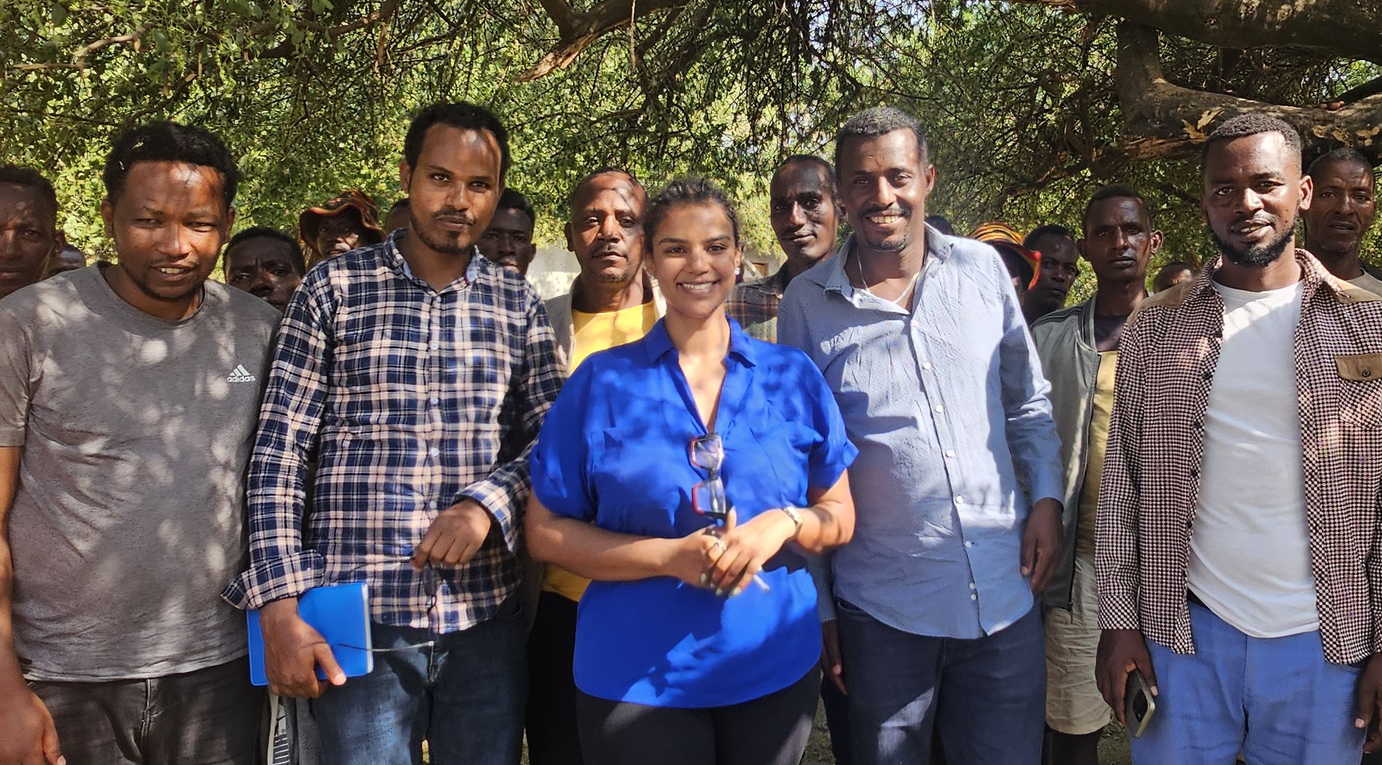
Dr Lensa Jotte with Garda Marta farmers, Ethiopia
"The farmers of Garda Marta are ready. The Ethiopian government is ready. The market is ready."
— Dr. Lensa E. Jotte, Founder & Director

SWaDE is raising a seed round of under £1 million to move from virtual validation to field-deployed, revenue-generating platform. We welcome conversations with investors aligned with climate-smart agriculture, agricultural data infrastructure, and emerging market fintech.

Beyond capital, we welcome introductions to agricultural lenders, crop insurers, and development finance institutions active in Sub-Saharan Africa, and conversations with potential data licensing or white-label partners.

lensa.jotte@swade.africa